Scouting Lake Murray
The Forrest Wood Cup is the biggest tournament in bass fishing, and you’ve likely heard a lot of chatter about the anglers in the field, the fishing techniques and all the events that surround the tournament. But how much do you know about Lake Murray itself?
We got into town early, and, rather than work, we decided to head out on the water for a tour of the lake. Here’s what we found.
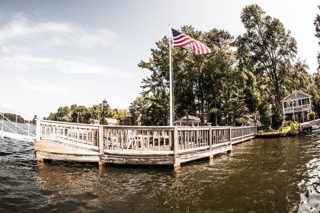
Dreher Island Takeoff Site
The takeoff site at Dreher Island State Park in Prosperity, S.C., is situated, more or less, smack-dab in the center of Lake Murray. That pretty well makes it an ideal takeoff point for a tournament. On opening morning this Thursday, fans will quickly be able to see who goes up the lake to fish the stained rivers and who goes down the lake to fish the clear, deep lower end. We chose to go upstream first on our scouting trip and pulled out at around 8:30. Weather conditions included a light breeze, mid-70s air temperatures and a soft gray haze that seemed to hang around the treetops.
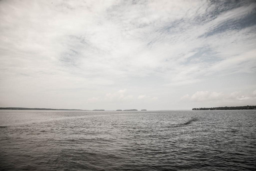
The Saluda River
Our first point of interest after leaving Dreher Island was the Saluda River, the main tributary of Lake Murray. Where “river” begins and “lake” ends was quickly noticeable when the steep shoreline common to the middle and lower sections shifted to flatter, bottomland contours. The water gradually took on a stain the farther we traveled from takeoff. Channel depth also decreased, from 60 to 80 feet down to 20 to 30 feet – even shallower than that in some areas.
The 391 Bridge
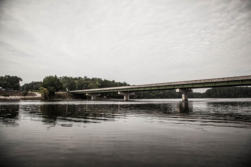
The Little Saluda River flows into the Saluda on the far western end of the lake, and just upstream from the confluence is the bridge where 391/Prosperity Highway crosses both rivers. It’s a good reference point for anglers making the run upstream. When we reached the bridge in the “big” Saluda arm, we saw a couple of anglers practicing nearby.
Water Clarity and Wood
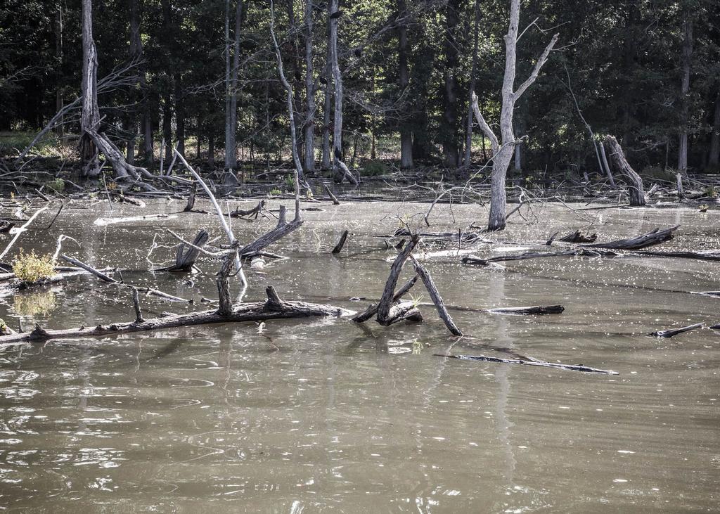
We continued up the Saluda, passed under a large power line and began exploring a section of Lake Murray that really feels like a different fishery than the lower end. Water visibility was nil, though that’s at least partially the result of more than 4 inches of rain soaking the region over the last week. We idled over shallow flats, photographed several miles of shoreline and island timber fields (yes, a flipping stick would have been handy), and eventually came to a far upriver boat access where the lake narrowed into a classic Southern river. Probably a few pros put in up there during their practice sessions. Our upstream expedition ended when we reached the bridge on 395/Kempson Bridge Road.
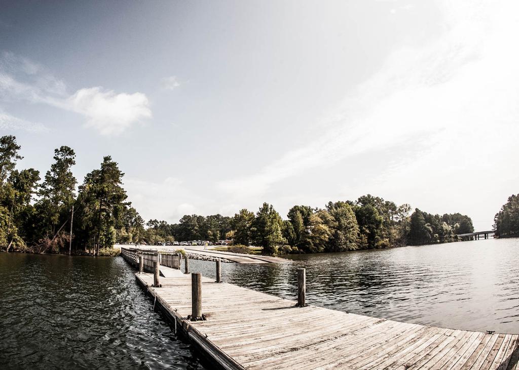
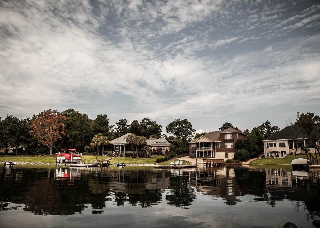
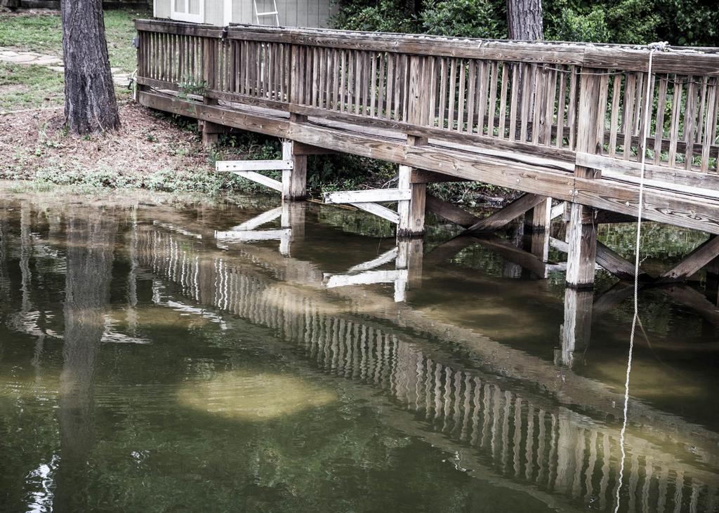
Mid-Lake Docks
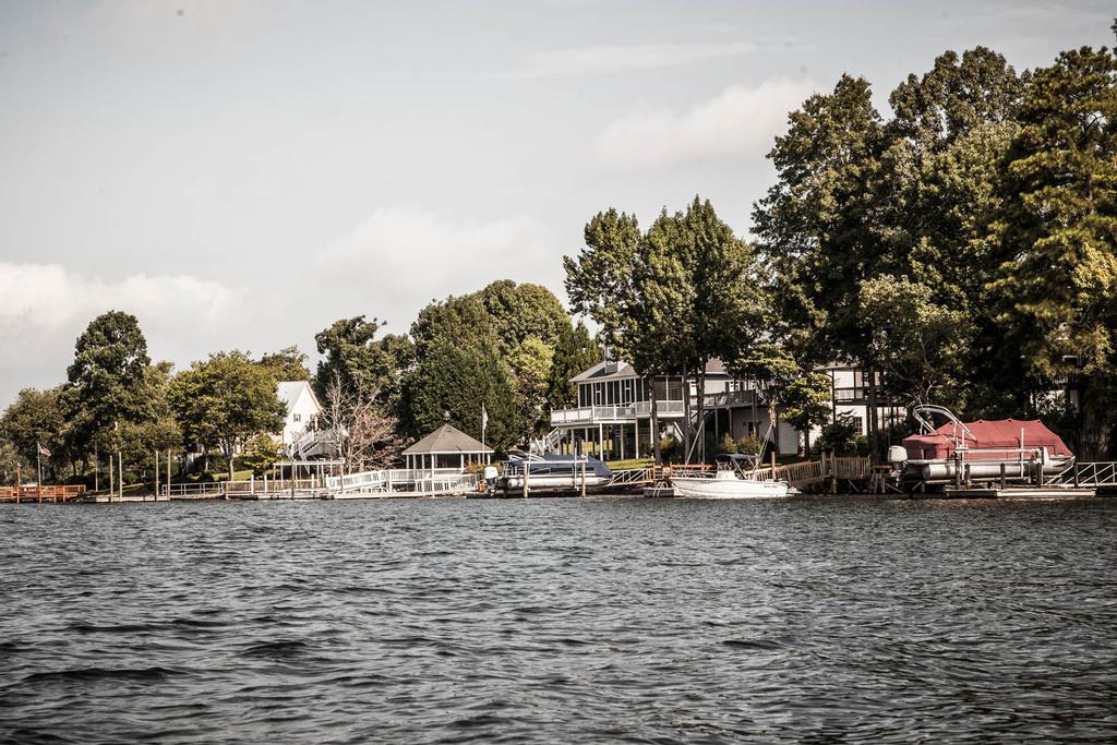
On the way back to the mid-lake area, we stopped at a few choice docks. Most of the docks in the middle part of the lake are the floating variety and are accessed by long wooden “boardwalk” walkways built on fixed wooden posts. This type of access is required where the shoreline is flat, if the owner wants his floating dock to be in deep enough water to tie off a boat. It also makes for fantastic shallow cover. For the dock fishermen in the field, Murray at least looks like the ultimate dock-fishing playground.
Islands
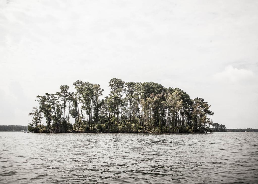
On the way back past Dreher Island, we stopped to chat with a couple more anglers who were chucking topwaters and soft jerkbaits, and we photographed a few of the many mid-lake islands. Several islands were actually used as bombing ranges during World War II. Training missions were launched from the Columbia Army Air Base, which is now a local airport. Dozens more sunken islands and humps could provide schooling fish with a little structure for their foraging. Islands also make good hiding spaces for anglers to escape the watchful eye of our media crew. Good thing we brought binoculars.
Green Water and Water Temperature
The best way to describe the water in the mid-lake area is “green.” It has just a bit of stain to it, with clarity of 2 to 3 feet at the surface. Water temperature seemed to consistently measure in the low 80s from one end of the lake to the other. According to early practice reports, that’s several degrees below the water temperature anglers found when they came to Murray for pre-practice.
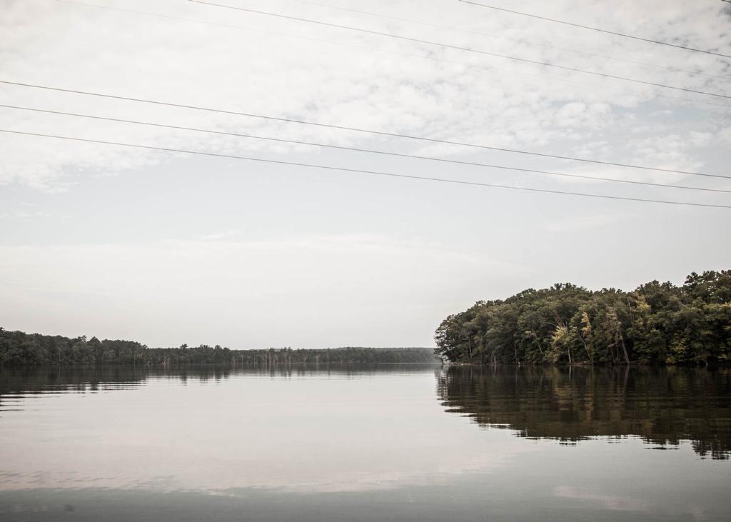
Opening Up
After rounding the islands near the tournament takeoff site, we arrived at the stereotypical Lake Murray scene: a wide-open expanse of clear, deep water. The lower end of the lake is vast, but it’s lined with miles of jagged shoreline, with thousands of dock-lined coves and cuts to hide anglers. There’s a lot of water to be fished down there.
The Dam
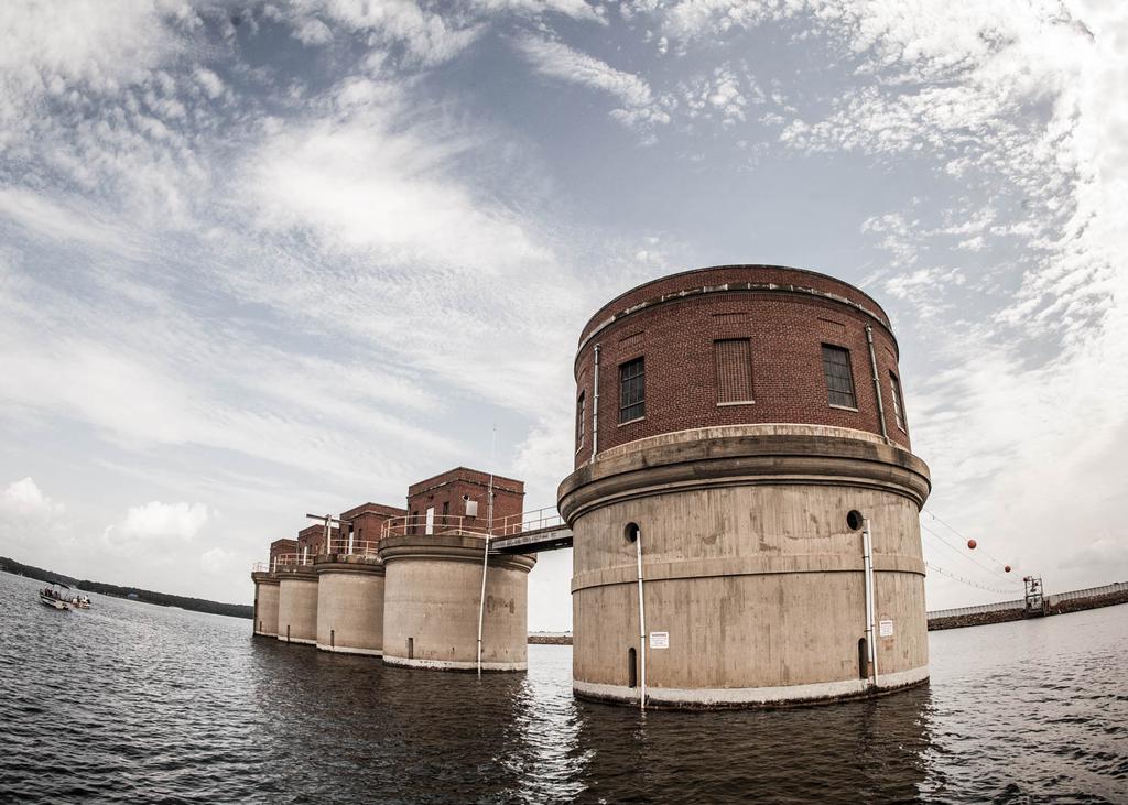
We ran straight to the Dreher Shoals Dam to check out the plug that keeps Lake Murray full of water. This sucker is massive. A walking path along the dam stretches 1.7 miles. Talk about a workout. We marked a healthy school of bait near the dam and watched a few striper anglers who were fishing nearby. Water clarity near the dam is about 4 feet.
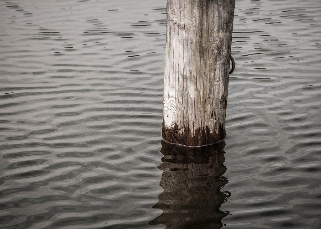
Bluegills on Beds
Probably the most interesting part of our excursion was a quick stop in a large pocket on the southern side of the lake near the dam. We dropped the trolling motor and went looking for a photo of a dock post that was visible partway under the water, to show off the water clarity. What we found instead was a colony of bluegill beds – massive bluegills beds. Each bed ranged from about 18 inches in diameter to close to 30 inches, and almost every one was tended by a bluegill. Could there be a bluegill bed pattern or wolf-pack bass deal working this week? It’s a story line to watch for.
Heading In
By lunchtime, the sun was up and the temperature had risen into the 80s. We tooled back across Lake Murray’s deep basin with our sun buffs on to block out the rays and opened up the Evinrude E-Tec. Blitzing across the water, it was fun to imagine what it’d be like to point a Ranger back toward Dreher Island with a livewell full of bass on the final day of the Forrest Wood Cup. For those of us here to cover the event in the media, it’s a daydream – a nice wish. But for 45 pros and co-anglers, it’s a real possibility. Luckily, they’ll have a diverse fishery for their playground this week at the 2014 Forrest Wood Cup.
Quick Bites
Tournament takeoff: Dreher Island State Park
Lake type: highland reservoir
Lake size: 50,000 acres
Shoreline: 500 miles
Major tributaries: Saluda River
Average water visibility: 4 feet
Primary species: largemouth bass
Minimum length requirement: 14 inches